Alárò City_Skidmore, Owings & Merrill (SOM)
CategoriesArchitecture

The Future of Urban Planning: How AI Technology is Impacting Smart Cities

Alárò City_Skidmore, Owings & Merrill (SOM)

Architizer’s Tech Directory is a database of tech tools for architects — from the latest generative design and AI to rendering and visualization, 3D modeling, project management and many more. Explore the complete library of categories here.

Urban planning has always been a complex, large-scale “brain teaser” for architects. It requires the collaboration of several disciplines: architects, urban planners, sociologists, anthropologists, environmentalists and transportation planners, and the coordination of many bureaucratic governing bodies. Throughout time, there have been many urban planning theories, such as Garden City by Ebenezer Howard or Le Corbusier’s modernist Radiant City concept, which explored new modes of city organization and ways of living by suggesting speculative social structures, resource management and nature integration practices.

Following the rapid technological advancements in the early 2000s, the concept of “smart cities” gradually emerged, eventually gaining significant traction during the AI boom. Today, AI technology has opened up new realms of possibility, where algorithms and data are added to the architect’s tool belt, aiming to create sustainable, efficient and livable environments for burgeoning populations. However, first, it is imperative to define what exactly constitutes a “smart city” as well as how architects can employ AI in today’s urban planning practices.

Delving into city design requires two distinctive modes of thinking: ways of designing urban networks and ways of maintaining them. AI-powered design tools can analyze vast amounts of data, such as environmental conditions, demographic trends and urban infrastructure, to propose optimized design solutions that meet specific criteria, such as energy efficiency, pedestrian flow or complex cultural norms.

Alárò City_Skidmore, Owings & Merrill (SOM)

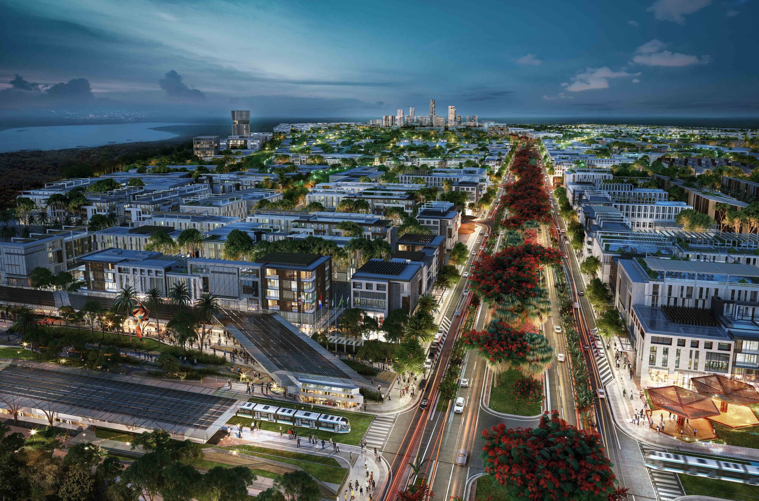
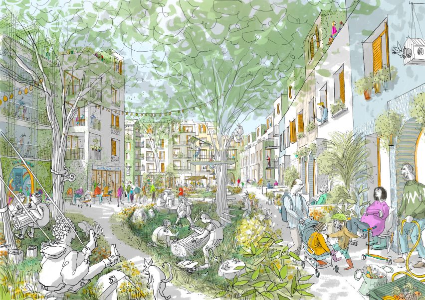
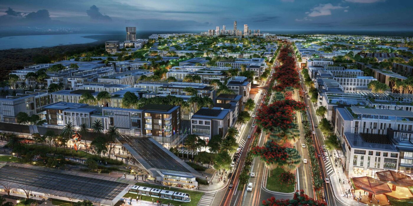
Alárò City by Skidmore, Owings & Merrill (SOM), Lagos, Nigeria

At the same time, architects can leverage AI planning tools to explore a broader range of design possibilities and quickly iterate through multiple schemes, as well as create responsive architecture proposals, which can adapt to changing environmental conditions and user preferences in real time. Responsive architecture designs also foster dynamic interactions between buildings and their surroundings, blurring the boundaries between the built environment and nature and promoting sustainable urban ecosystems.

On the other hand, AI technology can be incorporated in the actual design of buildings, where for instance, sensors and actuators can adjust lighting, temperature and ventilation based on occupancy levels, weather patterns and energy demand. It can also serve as the backbone of interconnected infrastructure systems throughout a city. AI algorithms can analyze traffic patterns to optimize road networks, predict maintenance needs for public utilities, and even detect and respond to emergencies, enhancing the overall resilience and reliability of urban infrastructure. In other words, AI becomes an integral part of a city’s operation and maintenance.

Architizer’s new Tech Directory aggregates tech tools for architects, allowing you to search, compare and review AI softwares before selecting which to you in your next project:

Explore Architizer’s Tech Directory

These AI applications are essentially two sides of the same coin. They expose both implicit and explicit ways of using AI for urban planning and thus broadening the definition of “smart” cities. For instance, projects such as Liam Young’s Planet City, present a new mode of urban design which could potentially be characterized as an archetypal “smart city”. While the use of AI technology is not explicitly stated, Planet City introduces concepts of interactive solar panels for powering the ten billion population imaginary city. It also presents a rather eccentric idea of having a non-stop planetary festival, where different cultural celebrations are revisited throughout the year to preserve the cultural diversity of human civilization.

These two examples of AI-driven practices push the boundaries of traditional urban planning. More specifically, the first is an obvious case of responsive AI technology that leads to a more sustainable living, whereas the second one suggests employing AI algorithms to collect sufficient data and propose optimal cultural and social structures within the new city.

SmartCity Springpark Valley

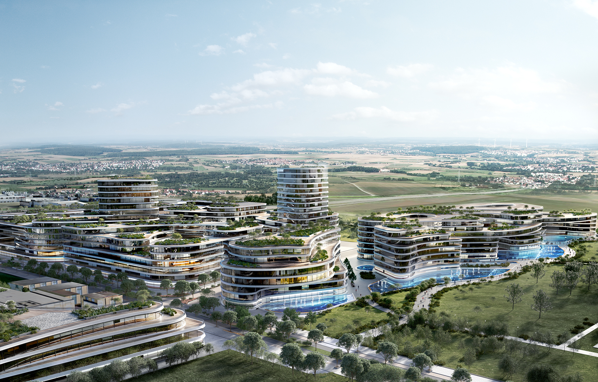
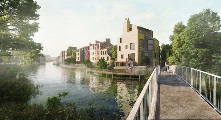
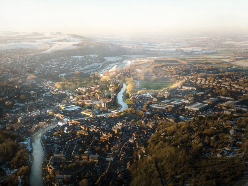
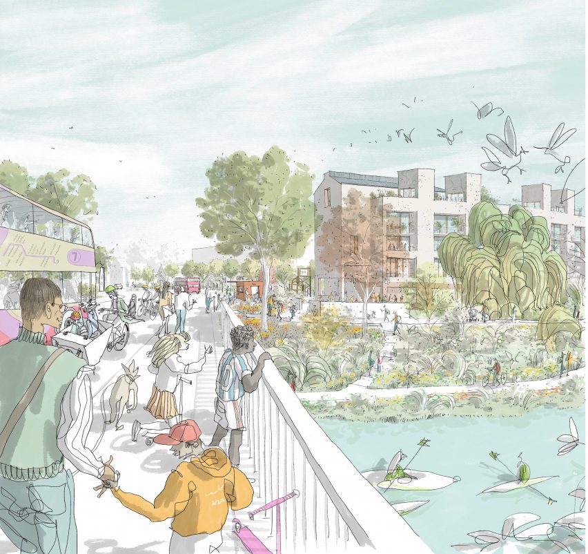
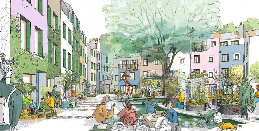
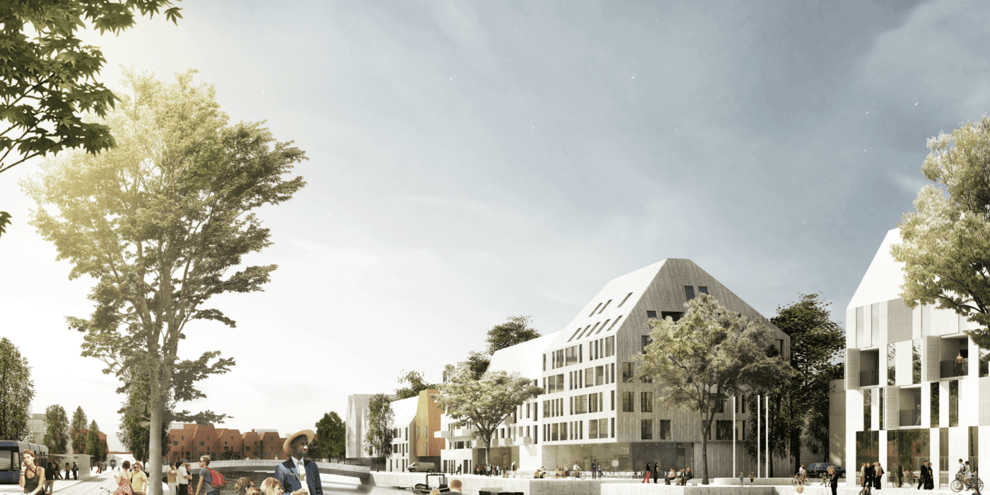
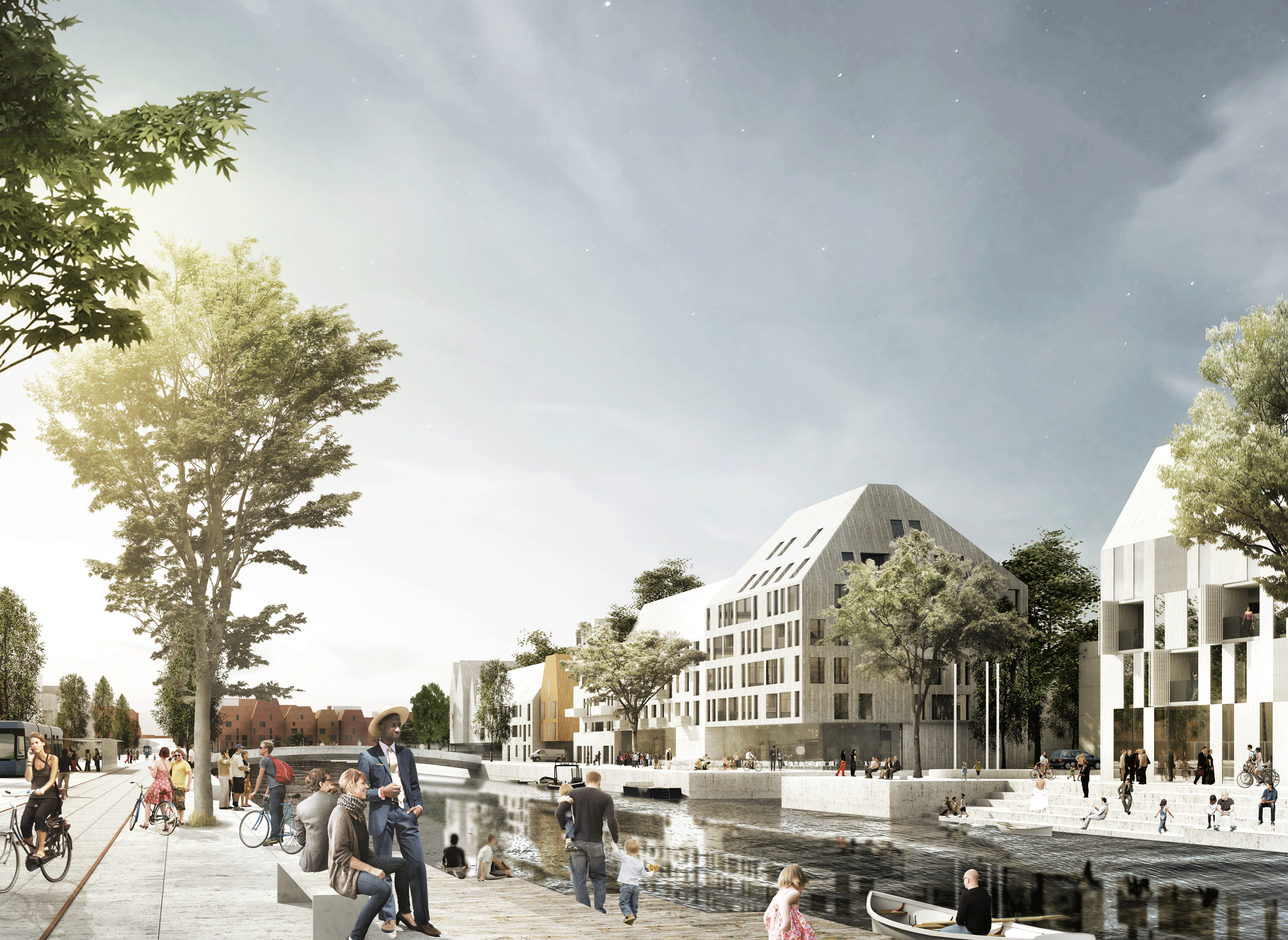
SmartCity Springpark Valley  by planquadrat Elfers Geskes Krämer GmbH, Bad Vilbel, Germany

Another world-famous project, well-known for its AI integration, is The Line: a futuristic city currently being built in Saudi Arabia. NEOM, the company behind The Line, stated its ambition to create a digital twin backbone through the use of AI tools that will aid the city’s construction and minimize carbon emissions and material waste. Still, a “smart city” does not necessarily have to be a tabula rasa project. Using AI tools to improve existing cities that carry hundreds of years’ worth of human history might arguably be the most important endeavor in urban planning.

One example is the Barcelona Smart City Project, which revitalizes public squares and parks and integrates AI technology such as smart lighting and noise sensors, thus enhancing the city’s livability. Furthermore, Barcelona embraced open data initiatives, thus encouraging the development of numerous urban planning tools and real-time information hubs that continuously improve the city’s operation and maintenance.

Admittedly, designing as well as managing a city is no simple task. Still, whether acting as a medium through which provocative thought-experiments are designed (speculating about future urban design practices) or offering ways of utilizing data to physically realize innovative building environments, AI offers tremendous potential for reimagining urban spaces. By tackling the challenges of the world’s largest urban metropolises and striving for pioneering urban regeneration practices, AI becomes a catalyst for creating more equitable, inclusive, and resilient cities for generations to come.

Architizer’s Tech Directory is a database of tech tools for architects — from the latest generative design and AI to rendering and visualization, 3D modeling, project management and many more. Explore the complete library of categories here.

Reference

The Phoenix sustainable neighbourhood by Human Nature
CategoriesSustainable News

UK’s “most sustainable” neighbourhood receives planning approval

The Phoenix sustainable neighbourhood by Human Nature

Development company Human Nature has received planning approval to transform a former industrial site in Lewes into a sustainable 685-home neighbourhood that will be the UK’s largest made from timber.

The Phoenix, which was granted planning permission last week, will be built from engineered timber and be the most sustainable neighbourhood in the UK, according to Human Nature.

The Phoenix sustainable neighbourhood by Human NatureThe Phoenix sustainable neighbourhood by Human Nature
The buildings in the Phoenix development will have engineered timber structures

“One year after proposals were announced for the transformation of a 7.9-hectare brownfield site into the UK’s most sustainable neighbourhood, the Phoenix development has today been granted planning permission, taking the visionary project a step closer to reality,” said Human Nature.

“When complete, it will be the UK’s largest timber-structure neighbourhood and a blueprint for sustainable placemaking and social impact that can be deployed at scale.”

Sustainable neighbourhood in Lewes by Human NatureSustainable neighbourhood in Lewes by Human Nature
It will be located on a former industrial site

Located in the South Downs National Park, the Phoenix will contain energy-efficient homes, public space and healthcare, retail, hospitality and industrial space, all constructed from engineered timber including cross-laminated timber.

It will be the largest structural timber neighbourhood in the UK by number of units, Human Nature’s head of sustainable construction Andy Tugby told Dezeen.

The buildings will range from two to five storeys tall and be clad in prefabricated panels made from locally sourced timber and biomaterials such as hemp.

Sustainable development in Lewes by Human NatureSustainable development in Lewes by Human Nature
A riverside walk will feature in the neighbourhood. Image by Carlos Penálver

Industrial structures on the site will be repurposed to house most of the community spaces, including a canteen, event hall, taproom, fitness centre, workspace and studios.

The Phoenix’ homes will be designed to be energy efficient and powered by renewable energy sourced from on-site photovoltaic panels and an off-site renewable energy facility.

Aiming to create a place for all generations and for people with mixed incomes, 30 per cent of the 685 residences will be affordable homes – 154 of which will be built to the government’s Local Housing Allowance rates and the remainder built as part of the First Homes scheme.

The Phoenix will be designed as a walkable neighbourhood that prioritises people over cars, with a mobility hub providing electric car shares, car hire, electric bike services and shuttle buses to help encourage a shift away from private vehicle use.

Public squares, gardens, community buildings and a riverside pathway that stretches the length of the site will provide space designed for interaction between residents.

Timber structure neighbourhood by Human NatureTimber structure neighbourhood by Human Nature
The development will contain energy-efficient homes

The Phoenix masterplan was designed by Human Nature’s in-house design team with UK architecture studio Periscope and Kathryn Firth, director of masterplanning and urban design at Arup.

Developed designs for the scheme will be made in collaboration with UK architecture studios Archio, Ash Sakula, Mae Architects, Mole Architects and Periscope and engineering firms Expedition Engineering and Whitby Wood.

Drawing of a park surrounded by buildingsDrawing of a park surrounded by buildings
The Phoenix aims to provide sustainable housing to people with a range of income brackets. Image by Carlos Penálver

Human Nature is a development company based in Lewes that was founded by former Greenpeace directors Michael Manolson and Jonathan Smales.

Other timber developments published on Dezeen include a zero-carbon housing scheme in Wales by Loyn & Co and Henning Larsen’s plans for Copenhagen’s first all-timber neighbourhood.

The images are by Ash Sakula, courtesy of Human Nature, unless stated.

Reference

Hiedanranta Innovation Bay
CategoriesArchitecture

From Suburbs to Hubs: Innovation Districts Usher In a New Era of Urban Planning

Hiedanranta Innovation Bay

The latest edition of “Architizer: The World’s Best Architecture” — a stunning, hardbound book celebrating the most inspiring contemporary architecture from around the globe — is now available. Order your copy today.  

In the heart of Tampere, Finland, the Hiedanranta Innovation Bay project is a shining example of urban transformation, challenging the conventional suburban model of isolated campuses without integrated housing or commercial areas. They represent multifaceted ecosystems encompassing research centers, universities, corporate offices, government agencies, healthcare facilities, cultural institutions and technology hubs. This diverse mix creates collaborative environments for interdisciplinary interactions, fostering creativity and advancing research and development. The inclusion of community spaces enhances engagement and shared amenities within these districts. Steering away from the conventional blueprint, these districts strategically leverage mass transit, emphasizing a departure from car-centric developments. Avoiding the trend of urban sprawl and fostering vibrant, community-centric urban living is a focal point.

However, the idyllic picture painted by innovative districts comes with challenges. Concerns like gentrification, the potential loss of a city’s unique character and rising housing costs accompany their development. As these districts attract investment and development, there is a risk of pushing out existing communities, altering the cultural fabric and contributing to rising property values. However, thoughtful urban planning and inclusive design strategies can address these concerns, ensuring that the benefits of innovation are shared equitably and that the district enhances rather than diminishes the overall quality of urban life.

Hiedanranta Innovation Bay

Hiedanranta Innovation Bay by Schauman & Nordgren Architects, Tampere, Finland.

There are proactive measures that local communities along with architects, planners, transportation specialists and environmental experts together can undertake to address these concerns. Engaging diverse stakeholders ensures a comprehensive approach that considers the needs, preferences and sustainability of the community, fostering a collaborative and inclusive urban development. The creation of ample public spaces, mixed-use development and initiatives for inclusive economic growth contribute to establishing a diverse and vibrant urban environment. Implementing smart transportation solutions further enhances accessibility, steering away from car-centric models. Through these strategic measures, professionals can transform innovation districts into positive contributors to communities, fostering economic growth, technological advancement and overall well-being.

The Hiedanranta Innovation Bay project in Tampere, Finland, aligns with the forward-thinking vision embraced by many cities aiming to integrate innovation districts into their urban landscape for the betterment of their economy, residents’ well-being, and environment. Upon completion, the Innovation Bay is set to accommodate over 25,000 new residents and generate 10,000 jobs. This transformation will convert the former industrial district into a dynamic innovation hub, emphasizing the principles of a circular economy and fostering sustainable development.

Metamorphosis in Steel City: The Assembly and Innovative Urban Living

In line with this transformative vision, another notable illustration is the project centered around Pittsburgh’s historic Ford Motor Plant. Undergoing a significant metamorphosis, this iconic site was reimagined as a hub for scientific research. The project encapsulates the essence of these evolving models of innovation districts, creating more integrated, sustainable, and vibrant communities.

The Assembly

The Assembly by ZGF Architects, Pittsburgh, Pennsylvania | Photo by Halkin Mason Photography Popular Choice Winner, 11th Annual A+Awards, Higher Education & Research Facilities 

The Assembly is the outcome of Pittsburgh’s historic Ford Motor Plant undergoing a transformation into a hub for scientific research, symbolizing a new era of innovation in the Steel City. Once part of the 31 Ford Motor Plants nationwide, this facility is now the home to the University of Pittsburgh and the Hillman Cancer Center, tailored for advanced cancer and immunology research. The building brings together academic researchers and private industry tenants in a central location.

The Assembly efficiently consolidates the elements of an innovation district within a single city block, incorporating ample amenity, retail, and conferencing space to attract top talent while benefiting tenants and the neighboring community. The district model prioritizes physical compactness and transit accessibility, reducing commuting barriers, and enabling researchers from different groups to easily connect. The incorporation of mixed-use spaces creates a dynamic environment that encourages collaboration beyond formal work settings.

Shaping Cities and Connecting Minds: The Hans Rosling Center’s Story

The positive impact of innovation districts extends beyond physical planning to encompass collaborative ecosystems. The interdisciplinary approach in their design brings together researchers from various fields, fostering a rich and diverse ecosystem that sparks innovative solutions and knowledge exchange. Adaptive workspaces cater to project-specific needs, enhancing the flexibility and responsiveness of the environment.

Illustrating the principles of innovation districts, The University of Washington’s Hans Rosling Center for Population Health stands as a compelling example of community-centric design that cultivates a sense of belonging, contributing to a collaborative spirit and facilitating the seamless flow of information among different research groups.

Hans Rosling Center for Population Health

Hans Rosling Center for Population Health by The Miller Hull Partnership, Seattle, Washington | Photo by Kevin Scott.

The University of Washington’s Hans Rosling Center for Population Health — named after a pioneer in the data-driven approach to health improvement — serves as a central hub for collaborative efforts among faculty, researchers and students. Endowed with a $210 million gift from the Bill & Melinda Gates Foundation and $15 million from the Washington State Legislature, the center focuses on human health, environmental resilience, and social and economic equity. Housing the Institute for Health Metrics & Evaluation (IHME), UW Department of Global Health, parts of the UW School of Public Health, and the offices of the UW Population Health Initiative, the center has played a crucial role in the global response to the COVID-19 pandemic. IHME’s projections have informed policymakers, and researchers have shared insights with major media outlets.

Designed to accommodate system shocks like pandemics, the Rosling Center’s layout features a variety of flexible office types, organized as neighborhoods, catering to different working styles. From 1–2-person shared offices to open workstations, each neighborhood encourages collaboration and innovation. The building’s design also includes a new accessible entry, a monumental covered porch, and an urban staircase, creating a welcoming space for the community and fostering intermingling among diverse groups.

Paving the Way for Sustainable and Inclusive Urban Futures

ResilienCity: Boston's Innovation District

ResilienCity: Boston’s Innovation District by MapLab, inc. Boston, Massachusetts

Innovation districts are supplanting the traditional suburban model of corporate research and technology campuses by prioritizing denser, mixed-use environments and transit accessibility, fostering collaboration, connectivity, and innovation. Unlike isolated suburban campuses, these districts integrate mixed-use spaces, emphasizing sustainable practices and community engagement. This shift aims to optimize urban spaces, reduce commuting barriers, and create vibrant, dynamic hubs that contribute to a more sustainable and interconnected urban future. Architects, planners and city authorities can take proactive measures to mitigate concerns associated with innovation districts. By adopting such measures, stakeholders can contribute to the creation of innovation districts that not only drive economic growth and technological advancement but also enhance the overall well-being and inclusivity of urban communities.

The latest edition of “Architizer: The World’s Best Architecture” — a stunning, hardbound book celebrating the most inspiring contemporary architecture from around the globe — is now available. Order your copy today.  

Reference

Sebastian Cox
CategoriesSustainable News

The UK’s new biodiversity net gain rules explained

Sebastian Cox

New planning legislation that aims to boost biodiversity in development projects will come into effect in England in January. Here, Dezeen explains what architects need to know.

What is biodiversity and why does it matter?

In this context, biodiversity usually refers to the variety of all species living within a certain area or ecosystem, including plants, animals, insects, bacteria and fungi.

Each species in an ecosystem has its own impact on the environment, affecting the availability of clean water and air, soil condition, pollination and other food sources and resources. Variety is necessary to keep all these elements in balance, maintaining a stable and resilient world for humans to survive in.

Many parts of the world are experiencing rapid biodiversity loss as a result of phenomena caused by human activities, such as pollution, climate change and habitat destruction. A Queen’s University Belfast study published earlier this year found that 48 per cent of the world’s animal species are experiencing population decline. The Worldwide Fund for Nature claims we are witnessing the sixth mass extinction event in the Earth’s history.

“We live in a time of mass extinction, where an alarming number of species are disappearing and where the impoverished ecology of the planet is having a detrimental effect, not only on our climate emergency, but also on pollination and in the production of food,” Adam Architecture director Hugh Petter told Dezeen. “It is a powder keg.”

Adam Architecture’s work includes Nansledan, an extension to the British city of Newquay that is being designed for the Duchy of Cornwall. The studio says it will surpass the new biodiversity net gain rules by adding “habitat ‘units’ of around 24 per cent and an increase in hedgerow ‘units’ of around 48 per cent”.

What are the new rules?

Construction can be a major cause of direct biodiversity loss, and the new planning rules for England aim to address that. They mandate that new developments deliver a “biodiversity net gain” – that is, a measurably positive impact on biodiversity compared to what existed before.

Specifically, the legislation requires developers to deliver a biodiversity net gain of 10 per cent. To calculate this, the UK government has produced a formula called the “statutory biodiversity metric” for counting what it terms “biodiversity units”, which are gained through work to create or improve natural habitats and lost through building.

As they strive to meet the 10 per cent requirement, developers must prioritise enhancing biodiversity on-site. If they cannot meet the threshold on the site being developed, they will be allowed also to make biodiversity gains on other plots of land, including by purchasing biodiversity units from other landowners.

As a last resort, they must buy “statutory biodiversity credits” from the government, which will use the money to invest in habitat creation. Biodiversity gains delivered must be maintained for a minimum of 30 years by whoever owns the land, bound by legal agreements.

Once planning permission is granted for a project, the developer must submit an evidenced biodiversity gain plan to the local planning authority (usually the council), which will approve it or refuse it. Development can only start once the biodiversity gain plan is approved. If the developer then fails to act in line with their biodiversity gain plan, the planning authority may take enforcement action.

Guidance on the new legislation, including a step-by-step guide to compliance, is available on the UK government’s website.

When do they come into effect?

The legislation was initially intended to come into effect for large developments of more than 10 dwellings in November, but that was pushed back to January 2024.

Smaller sites will also be subject to the new rules from April 2024, while major infrastructure projects will have to comply from late November 2025.

Some sites, such as small custom-built housing developments, will continue to be exempt.

What do architects and landscape architects need to know?

Architects and landscape architects will likely play a leadership role in ensuring that projects deliver on biodiversity requirements, working with ecologists and the authorities.

The most important thing, says Petter, is to understand the importance of biodiversity loss as an issue.

“The more architects can take a proper interest in the subject, the better placed they will be to work with the spirit of the new legislation and to think of imaginative ways that the minimum standards can be exceeded,” he said.

“It is crucial to engage with an ecologist as soon as possible,” added RSHP sustainability lead Michelle Sanchez. “It is also beneficial to evaluate the site as soon as you gain access.”

“This enables you to develop your designs based on the existing level of biodiversity, tailoring your strategy to local flora and fauna you particularly would like to support,” she said.

One thing to bear in mind is that the new rules aim to prioritise avoiding biodiversity loss in the first place.

“Avoiding biodiversity loss is the most effective way of reducing potential impacts, and it requires biodiversity to be considered at early design stages,” the guidance states.

To gain planning permission for a project that does cause biodiversity loss but proposes strategies to replace it, developers will need to explain, with evidence, why avoidance and minimisation is not possible.

Will this actually help to boost biodiversity?

The rules will mark the first time biodiversity enhancement has been a planning condition in England. According to University of Oxford researcher Sophus zu Ermgassen, it represents “one of the world’s most ambitious biodiversity policies”, but the exact impact is not yet certain.

But Sanchez is broadly optimistic. “Developers were not inclined to consider biodiversity enhancement in the past,” she told Dezeen.

“Only on projects attaining sustainability certificates such as BREEAM would biodiversity targets be discussed. Even then, it would sometimes more regarded as a tick-box exercise rather than an opportunity to make the building better and more appealing and to reduce the environmental impact that architectural projects have on the planet.”

However, she has warned in an opinion piece for Dezeen that a 10 per cent net gain on its own “is not enough to be able to reduce the negative impact that our way of life has had on biodiversity”.

The photo is by Free Steph via Unsplash.

Reference

Punjab plans to set up Strategic Planning Unit to revise Rawalpindi’s master plan Zarkon Group Real Estate Developer & Property Builder - FAH33M
CategoriesNews

Punjab plans to set up Strategic Planning Unit to revise Rawalpindi’s Master Plan

Punjab plans to set up Strategic Planning Unit to revise Rawalpindi’s master plan Zarkon Group Real Estate Developer & Property Builder - FAH33M

Punjab plans to set up Strategic Planning Unit to revise Rawalpindi’s Master Plan

RAWALPINDI: Realising the need to revise Rawalpindi’s master plan, the Punjab government is planning to set up the Strategic Planning Unit at the commissioner’s office.

Though, the Rawalpindi Development Authority (RDA) had commenced work on revising the master plan, it failed to proceed with it due to lack of capacity.

Rawalpindi’s first master plan was outlined in 1968 when the city was made an interim federal capital. However, once the government offices were shifted to Islamabad, the plan was not enforced. Nearly 30 years later, another master plan was prepared by a board of officials for the period 1996 to 2016.

However, when the Capital Development Authority (CDA) started work on revising its master plan, the Punjab government also felt the need to do the same with the garrison city’s master plan as both cities were interlinked and their administrations had disputes over boundaries.

Urban sprawling turned villages into cities, causing environmental issues, commissioner says

A senior official of the Rawalpindi district administration told Dawn that green areas had shrunk due to mushroom growth of housing societies.

“Interestingly, Rawalpindi city lost its green areas in the last 20 years; there is no farm around the city as development projects were squeezing agricultural lands,” the official said.

He said under the law, a greenbelt had to be established around the city to make it pollution free but legal and illegal housing societies grabbed agricultural lands, adding that the RDA failed to keep an eye on the housing societies.

The official said the residential, commercial and industrial areas need to be streamlined as do the green areas.

According to the official, there are a number of planning agencies as far as the city’s growth and building control are concerned, including the RDA, cantonment boards, the Rawalpindi Municipal Corporation, the district administration and the housing and planning departments.

“These agencies have their own by-laws, work independently and without any centralised coordination or even direction,” he added.

On the other hand, Rawalpindi Commissioner Gulzar Hussain Shah said in line with the vision of Prime Minister Imran Khan, protection of agricultural land and lush plots had been ensured under the Punjab Land Rules 2020.

He said work on Rawalpindi’s master plan would be carried out on priority basis for which a Strategic Planning Unit would be set up in the commissioner’s office.

This unit will review the implementation of federal and provincial laws in mega projects in Rawalpindi, he added.

Meanwhile, the commissioner also held a meeting to review work on the master plan and urban development under Punjab Land Rules 2020. The meeting was attended by all deputy commissioners of Rawalpindi Division and other officials concerned.

Commissioner Gulzar Hussain Shah said due to urban sprawling, “our villages have also turned into cities which is causing many environmental problems”, adding that long-term and short-term planning was being done under the government’s policy to stop this process.

He said the process of construction of houses on agricultural lands would be discouraged under the law and vertical constructions would be promoted in the city limits and for this, the traffic, sewerage and water supply systems in the city would be developed in a modern way.

He said regular analysis of population growth in Rawalpindi during the last eight years should be done which would be helpful for future urban development strategy.

The commissioner said the site development zones of Rawalpindi tehsil would be created and regular urban development planning would be done by demarcating urban boundaries.

He said close cooperation between Rawalpindi Metropolitan Corporation, Rawalpindi Development Authority, Local Government and Community Development and Rawalpindi and Chaklala cantonment boards was very much needed in the process of urban development of Rawalpindi.

If you enjoyed this story, check out PM Imran launches Cadastral Map of Islamabad to ‘Defeat Qabza Groups’

More from NEWS & REAL ESTATE BUILDERS & DEVELOPERS:

PM Imran launches Cadastral Map of Islamabad to ‘Defeat Qabza Groups’

8 Beachside Homes That Are a Surfer’s Paradise

Lower Interest Rates, government incentives pour investment in construction sector

E-Build Pakistan: Pakistan’s First Ever Online Buy & Sell Construction Industry Material & Services Portal

Prayer mat helps mosque-goers socially distance

The post Punjab plans to set up Strategic Planning Unit to revise Rawalpindi’s Master Plan appeared first on Dawn News