Using community-sourced data for climate resilience
CategoriesSustainable News

Using community-sourced data for climate resilience

Spotted: The UNICEF Venture Fund collaborates with innovators to develop solutions for the challenges facing the world’s children. Last year, the Fund launched an open call for a new project focused on Climate Tech. More than 400 companies applied, and Equinoct became the sole Indian startup to win funding from the maiden Climate Tech Cohort Venture Fund Project.

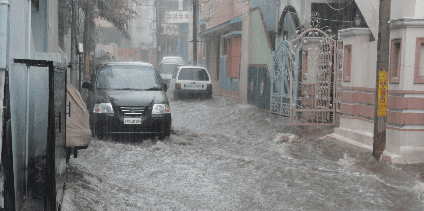
Equinoct has developed a community-sourced flood forecast and early warning system. The project combines work with local organisations, including workshops on disaster risk reduction through building community resilience, with manual data gathering on rain, river levels, and more.

The data is combined with initiatives, such as the distribution of thousands of tidal flood mapping calendars to individual households and involving children in information gathering and dissemination. The goal is to use community-sourced information to monitor and mitigate climate change-induced disasters and prevent loss of life and property.

The UNICEF funding will be used to automate some existing initiatives, including groundwater monitoring stations and a flood monitoring system, through the application of technology such as AI and machine learning.

Climate resilience is at the forefront of a host of new innovations, including the use of AI and satellite data to identify risks to utilities and a platform that helps smallholders with predictive analysis of weather and access to markets.

Written By: Lisa Magloff

Reference

AI and satellite data improves the resilience of cities
CategoriesSustainable News

AI and satellite data improves the resilience of cities

Spotted: Cities around the world are preparing for the likelihood of more frequent and severe heat waves in the coming years, with large urban areas at risk of turning into heat islands that are up to eight degrees Celsius warmer than surrounding rural areas. Yet many governments are wholly unprepared for the speed at which climate experts predict changes will occur.

Sustainable solutions are a must, and green walls and roofs, along with urban forests, could be some of the most effective. One company trying to make management of those assets easier and more effective is Luxembourg-based greentech company WEO. WEO uses artificial intelligence analysis of publicly available satellite imagery to provide low-cost, highly detailed analysis of the built environment.

WEO’s platform is available in two formats: Resilient Cities and Risk Management. The platform provides city planners and utility companies with insight into where heat islands occur, where so much soil is covered that runoff is at dangerous levels, and where trees pose a risk to power lines. WEO’s analytics improve the quality of lower-resolution data from satellite imagery and then the company uses machine learning to extract advanced insights for risk assessment and monitoring.

Resilient Cities’ analysis provides detailed data up to one metre in resolution that helps urban planners and local governments measure the growth and health of trees, track canopy cover, and reduce rainfall runoff. ‘Risk Management’, meanwhile, reviews the proximity of trees to utility infrastructure, maps areas of potential flooding, and highlights areas of especially flammable vegetation that should be cleared to prevent wildfires.

The affordability of the service is an important part of WEO’s goal to make cities more resilient, with the company highlighting that its technology is significantly cheaper than laser scanning, drones, or aerial surveillance. Additionally, the company emphasises its desire to work with partners for long-term projects that make the best, and fullest, use of its regularly updated data.

Satellites are increasing safety and efficiency in a number of industries, with innovations spotted in Springwise’s library including wildfire prevention and tropical weather forecasting.

Written By: Keely Khoury

Reference

Architects’ Guide: Short and Long Term Design Strategies for Flood Defense and Urban Resilience
CategoriesArchitecture

Architects’ Guide: Short and Long Term Design Strategies for Flood Defense and Urban Resilience

Architizer’s 12th Annual A+Awards are officially underway! Sign up for key program updates and prepare your submission ahead of the Main Entry Deadline on  December 15th.  

With over half of the world’s megacities located along coastlines, many are at risk of experiencing rising sea levels and potential flooding. Projections suggest that by 2050, sea levels will increase by 0.25 inches (0.65 centimeters) per year. Cities around the globe are increasingly embracing comprehensive coastal resilience initiatives to address the urgent challenges of climate change. With climate change triggering a range of impacts, including the alarming rise in sea levels, extreme storm surges and high tides, urban areas are recognizing the need for proactive strategies to safeguard their coastal regions and the communities within them.

A diverse array of measures and actions — including nature-based and/or man-made defenses — are aimed at fortifying cities against the adverse consequences of coastal hazards. The impacts encompass not only the physical encroachment of water onto land but also the destructive effects on infrastructure, buildings, open spaces, and the well-being of urban populations.

Adapting the built environment to reduce the impact of flooding could include building codes, restricting construction in at-risk areas, and planning to live with water. Inevitably, moving away from the coastline will occur in some places. Proactive, managed retreats will have significantly lower social and economic impacts than forced, reactive retreats after the event of coastal flooding.

Fostering Resilience Through City Initiatives and Guiding Principles
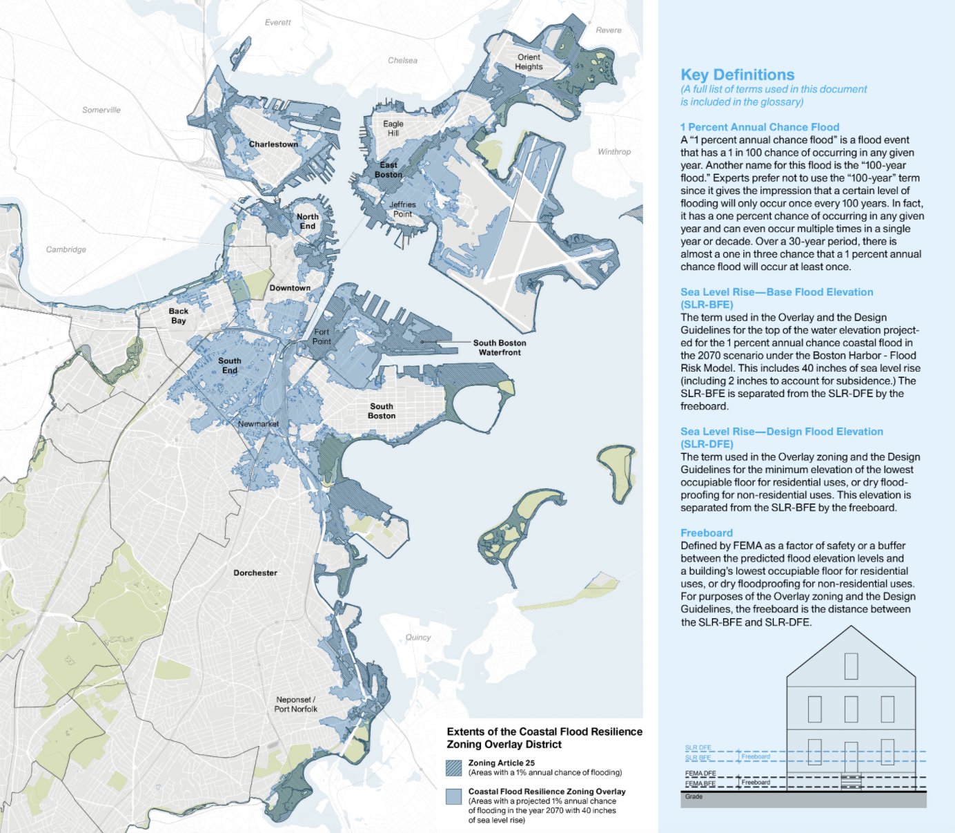
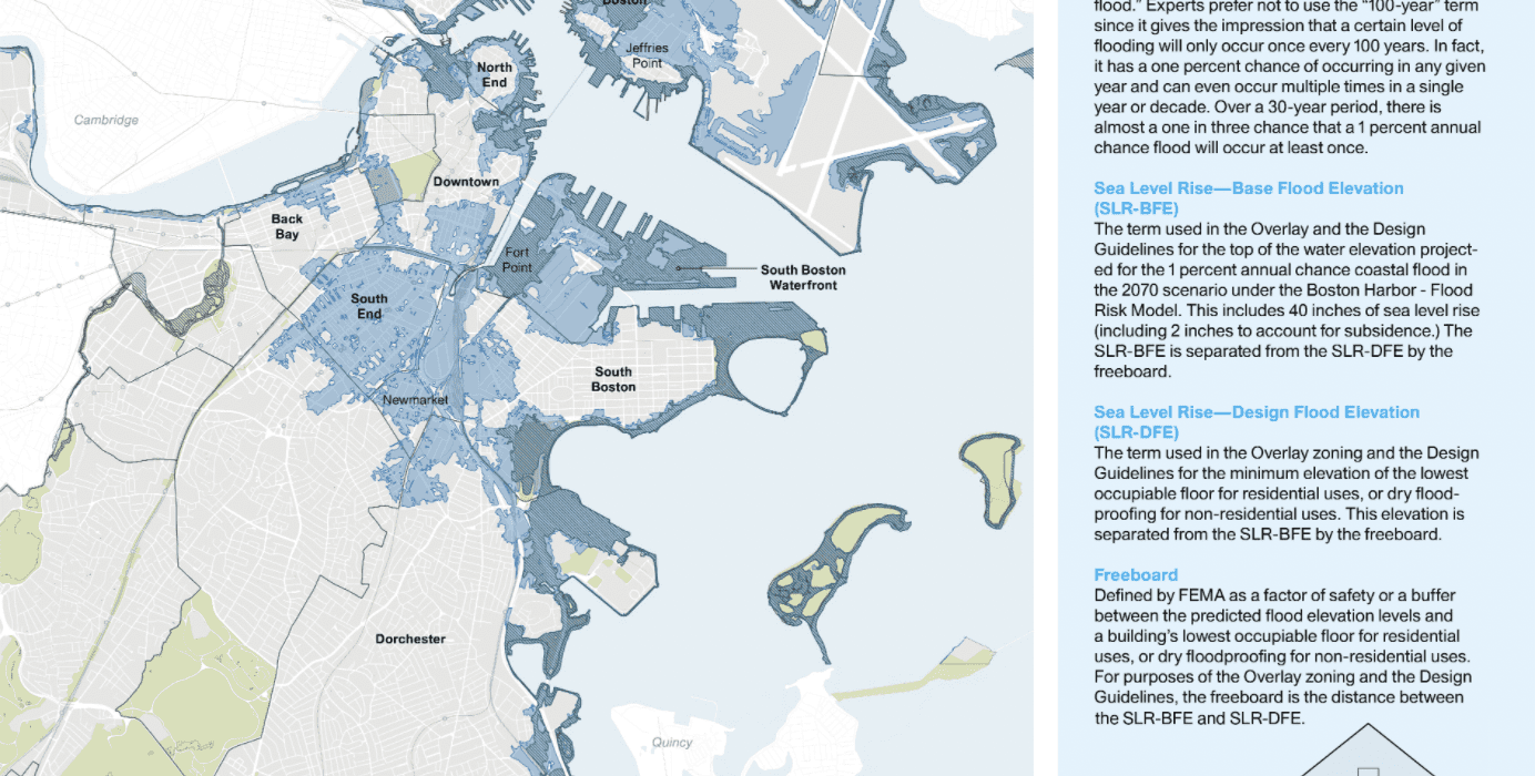
Boston Coastal Flood Resilience Design Guidelines and Zoning Overlay District.

Boston Coastal Flood Resilience Design Guidelines and Zoning Overlay District by Utile, Inc. Boston, Massachusetts, United States.

Resilient design principles serve as essential tools for municipal authorities, property owners and developers, facilitating informed, forward-looking decisions related to flood protection for existing structures and new construction. By following these guidelines, cities can minimize damage and disruption, all while fostering greater awareness among residents and businesses. The uniqueness of each at-risk location is considered in the design, tailoring strategies to the specific circumstances. For example, Boston has implemented initiatives like Climate Ready Boston and the city’s Coastal Flood Resilience Guidelines, which are exemplary instances of resilient design in action.

As a crucial component of the city’s Climate Ready Boston ongoing initiative, Utile spearheaded the creation of Boston’s first Coastal Flood Resilience Design Guidelines in collaboration with the Boston Planning and Development Agency. These guidelines, applicable to existing and forthcoming developments, ensure that structures are constructed or adapted to withstand the threats posed by sea level rise and storm surge. This initiative will be facilitated by a future zoning overlay, encompassing areas at a 1% risk of coastal flooding by 2070.

Working alongside Kleinfelder, Noble, Wickersham & Hart, LLP, and an advisory team featuring HDR and Offshoots, Inc., Utile employed a comprehensive project approach. This approach integrated national best practices, current regulations, analysis of Boston’s urban landscape, community input, and expertise in cutting-edge building technology. The Guidelines seamlessly complement various other initiatives within the Climate Ready Boston program, including neighborhood plans, public right-of-way guidance and existing zoning.

With a focus on retrofitting, the guidelines incorporate case studies outlining short- and long-term adaptation strategies tailored to the most common building types in flood-prone areas, effectively communicated through clear, concise graphics. Additionally, our zoning recommendations facilitate the implementation of these enhancements while striking a balance between private interests and their impact on the public domain.

Resilient Infrastructure: A Canvas for Innovative Design

Efforts to enhance flood defense and adapt to rising sea levels represent a design opportunity. These initiatives not only mitigate coastal hazards but also serve as remarkable engineering, architectural and urban creations. They blend aesthetics and functionality, fostering resilient, sustainable and visually appealing solutions that enhance urban landscapes while addressing climate challenges.

Located between St. Pauli Landungsbrücken and Baumwall in Hamburg, the new 2,050-feet (625-meter) Zaha Hadid Architects’ river promenade at Niederhafen is a vital component of the city’s upgraded flood protection system. Initially established in response to the catastrophic storm surge floods of 1962, which claimed 315 lives and displaced 60,000 residents, Hamburg’s flood barrier was erected between 1964 and 1968, reaching up to 24 feet (7 meters) above sea level.

Subsequent hydrological analysis and computer simulations pinpointed the necessity of raising the barrier by approximately 3 feet (1 meter) to fortify Hamburg against future winter storm surges and extreme high tides. Inspections in 2006 exposed overloaded supporting elements and foundation challenges, leading to a design competition and, eventually, the selection of Zaha Hadid Architects for the project.

The Niederhafen flood protection barrier occupies a prominent location encompassing Hamburg’s renowned riverside promenade — a tourist attraction and one of the city’s main public spaces. From its elevated position, the promenade provides unobstructed views of the Elbe River and the bustling port.

The finished project has reconnected Hamburg’s Niederhafen flood protection barrier with the city’s urban fabric, providing a popular riverside walkway and facilitating connections with nearby neighborhoods. The barrier’s eastern section stands 8.60 meters above sea level, while the western part reaches 8.90 meters, safeguarding the city from maximum winter storm surges and high tides. With a minimum width of ten meters (approximately 33 feet), the riverside promenade offers ample space for pedestrians, food vendors, cafes, shops, and public amenities at street level, enhancing its appeal as a vibrant public space.

Envisioning the Future: Flood Protection Infrastructure as Urban Catalyst
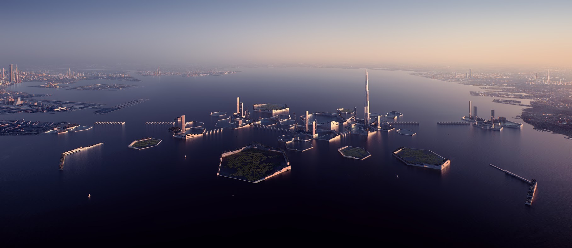
Next Tokyo 2045

Next Tokyo 2045 by Kohn Pedersen Fox Associates, Tokyo, Japan.

The potential of flood protection infrastructure goes beyond its primary role as a safeguard against inundation. It has the capacity to provide the groundwork for the creation of dynamic recreational open spaces and the expansion of high-density urban communities.

Next Tokyo 2045 envisions a resurgent megacity that that adapts to the challenges of climate change by establishing a high-density eco-district firmly underpinned by robust infrastructure. This archipelago of reclaimed land is planned to accommodate half a million residents, while fortifying Tokyo Bay against various water-related risks, such as rising sea levels, seismic activity and an increased frequency of typhoons.

Next Tokyo 2045 addresses the vulnerability of the low-elevation coastal zones around Tokyo Bay by implementing coastal defense infrastructure along the upper Tokyo Bay shoreline. Not only do these resilient infrastructural components enhance the city’s safety, but they also lay the groundwork for the creation of recreational open spaces and the development of high-density urban areas across the bay. This ambitious vision even includes the remarkable Sky Mile Tower, reaching over 5,250 feet (1,600 meters) in height.

As part of this development strategy, a share of the value generated from this newly coveted waterfront real estate will be allocated to support the essential municipal infrastructure required to sustain this urban transformation.

Safeguarding Cities: Resilience, Collaboration, and Urban Innovation
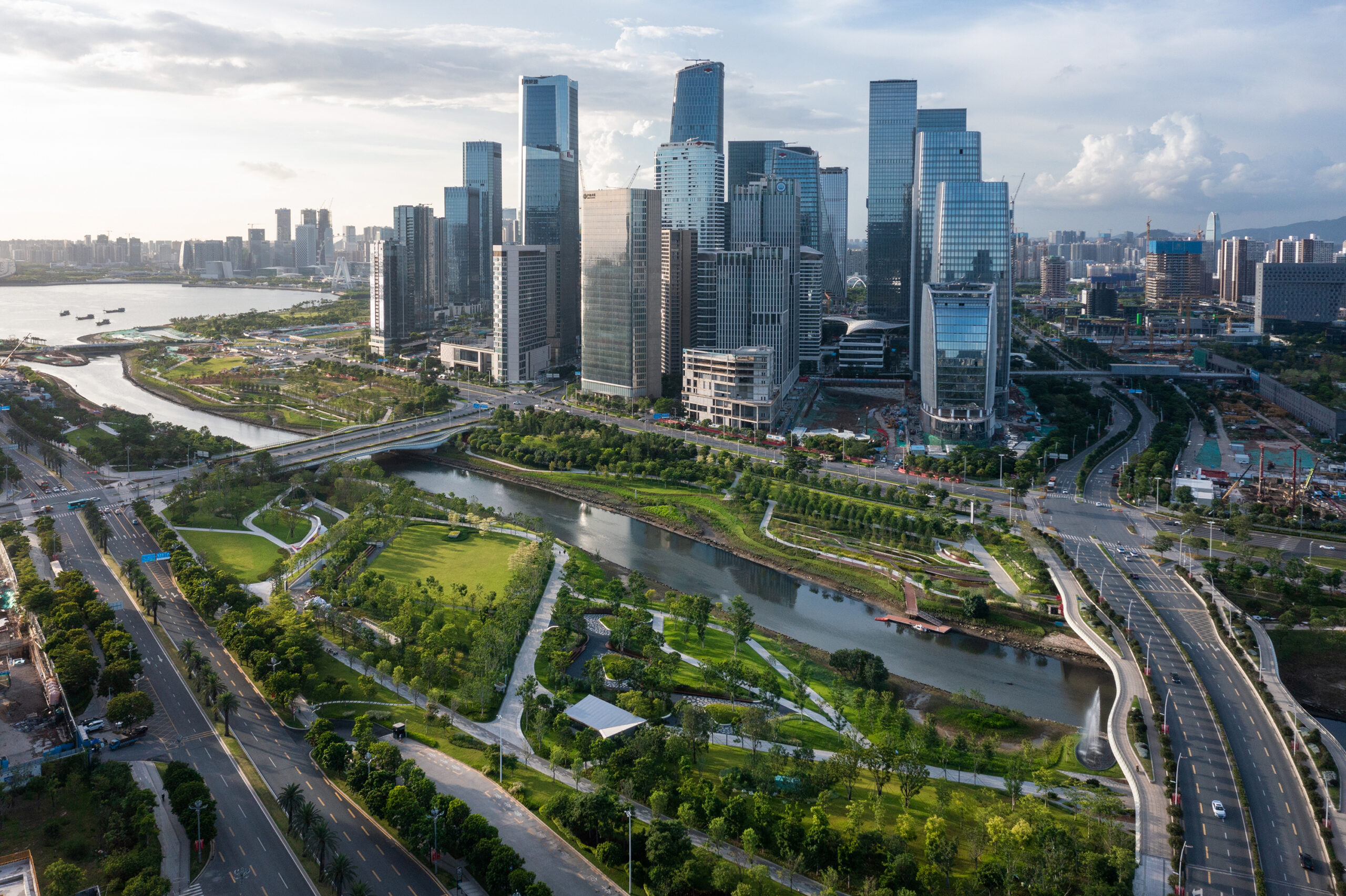
Qianhai’s Guiwan Park by Field Operations, Shenzhen, China | Jury Winner, 11th Annual A+Awards, Architecture +Urban Transformation

Cities are proactively implementing strategies not only to shield themselves from coastal hazards but also to create resilient, sustainable urban environments that can navigate the challenges of climate change. These coastal resilience initiatives aim at safeguarding current and future community well-being.

Collaboration and coordination among cities are pivotal, enhancing the effectiveness of actions and resource pooling, as the decisions of one location can affect neighboring areas. Coordinated efforts at various levels bolster regional climate resilience and promote the exchange of tools and knowledge. Moreover, community engagement is paramount to ensure inclusive action plans that address the needs of the most vulnerable populations.

The visionary Next Tokyo 2045 project demonstrates the potential of flood protection infrastructure extending beyond its core purpose. It not only safeguards against flooding but also serves as the foundation for the development of vibrant recreational open spaces and the growth of high-density urban communities. This innovative approach aligns resilience with urban expansion, showcasing how infrastructure can play a multifaceted role in shaping the future of cities.

Top image: Bai’etan Exhibition Center Landscape by Sasaki, Guangzhou, China Popular Choice Winner, 11th Annual A+Awards, Sustainable Landscape / Planning Project

Architizer’s 12th Annual A+Awards are officially underway! Sign up for key program updates and prepare your submission ahead of the Main Entry Deadline on  December 15th.  


Reference

Start with SIP Panels: Cost Savings, Efficiency, Health, Resilience
CategoriesSustainable News Zero Energy Homes

Start with SIP Panels: Cost Savings, Efficiency, Health, Resilience

Healthy homes for a healthy planet

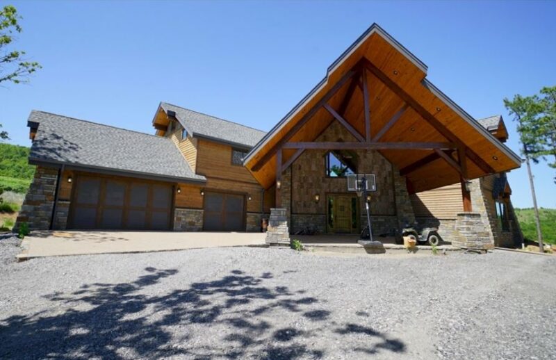
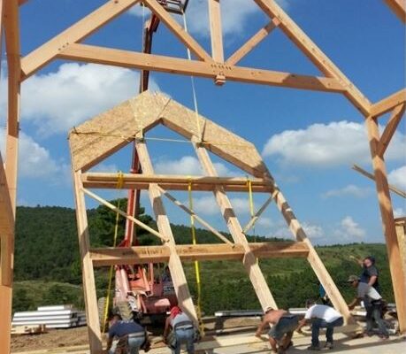
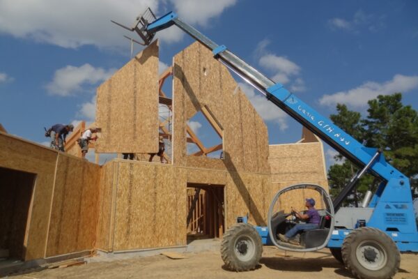
A building envelope is the armor that protects inhabitants, as well as interior finishes, furnishings and equipment. In the walls, roof, flooring, healthy materials are important to anyone suffering respiratory problems, like allergies and asthma. A well-designed home envelope is durable, healthy, insulating, and tightly sealed. Panelized construction homes are engineered to bring these qualities together.

In a well-sealed building, fresh air is provided through controlled ventilation systems, ensuring occupants breathe healthier, filtered air, and removing pollutants produced inside the home (dust, CO2, natural gas byproducts, etc.). Heating and cooling are maintained more efficiently and more comfortably, without leaking conditioned air through gaps in doors, walls, and ceilings. This means no drafts or ingress of polluted air, particularly during pollen or smoke advisories! SIPs have uniform insulation, which means there are no cavities where moisture might accumulate and promote mold, mildew, or rot.

Where you’re stopping air leaks you’re also blocking noise transmission pathways, leading to a quieter, and perhaps more private, living situation.

The components in insulated panels (including adhesives) meet some of the most stringent standards for indoor air quality, with low off-gassing. SIP panels have such low formaldehyde emission levels that they easily meet or are exempt from US Housing and Urban Development and California Air Resources Board (CARB) standards.

Reference

Liquid City: A Radical New Masterplan in Rotterdam Embraces the River for Resilience
CategoriesArchitecture

Liquid City: A Radical New Masterplan in Rotterdam Embraces the River for Resilience

Architizer is thrilled to announce the winners of the 11th Annual A+Awards! Interested in participating next season? Sign up for key information about the 12th Annual A+Awards, set to launch this fall.

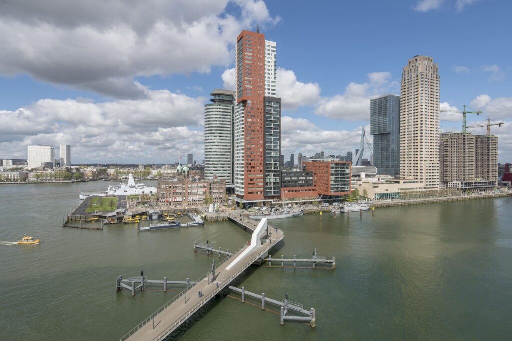
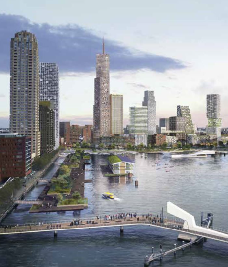
Popular with hip foodies and craft beer lovers, Fenix Food Factory’s generous outdoor seating area overlooks Rijnhaven. An old industrial harbor, over decades, it has seen shipping disappear under the boot of urban development.

After docklands moved west towards, and now into, the North Sea, a new district has sprung up in this corner of Rotterdam, extending the city center. Shops, residential blocks, floating structures housing offices and hospitality have replaced redundant warehouses and cranes.

The stunning Hotel New York overlooks all of this new development. The iconic building dates to the late-19th century, when it housed Holland America’s headquarters. The ocean liner route to Hoboken, New Jersey, carried close to 500,000 passengers from mainland Europe in its first twenty-five years of operation, and some will be immortalized when the FENIX Museum of Migration opens in 2024.

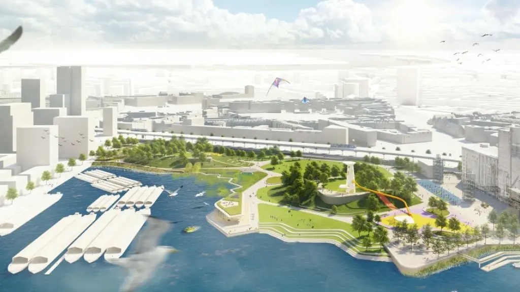
At the closed end of the quay, early signs of Rijnhavenpark are materializing — if you know what to look for. A large section of the harbor is cordoned off with buoys, and machinery has arrived to start the mammoth task of filling in one-third of the basin to create a huge public park, partly built on dry land, part floating on water, connected by walkways. The scheme is just one of several remarkable undertakings by the municipality of Rotterdam, transforming how the city interacts with its riverfront.

City Projects Rotterdam Rijnhaven

Rijnhaven, Rotterdam by Ossip van Duivenbode/Rotterdam Partners


Artist’s impression of Rijnhavenpark by City Projects/Rotterdam Partners

A delta town, the surrounding region of the Netherlands is home to the huge Rhine-Meuse-Scheldt delta, and has seen vast amounts spent on flood defences as a result. Known as Delta Works, modern protective infrastructure first broke ground in 1954 and construction only finished around 1997. Rotterdam’s Maeslantkering was one of the final pieces in a jigsaw of sluices, locks and dams. An enormous floodgate that took six years to build, it remains one of the planet’s largest moving structures.

A new masterplan comprising a series of large scale City Projects for central Rotterdam, many of which actively embrace the river itself, serves as a clear reminder of how vulnerable a city is when large parts lie below sea level — however, it also serves as a source of inspiration for design ingenuity. This scheme includes planting flora at different tidal levels, meaning that green spaces change with the time of day and actively supporting aquatic life, mammals and birds in the process.

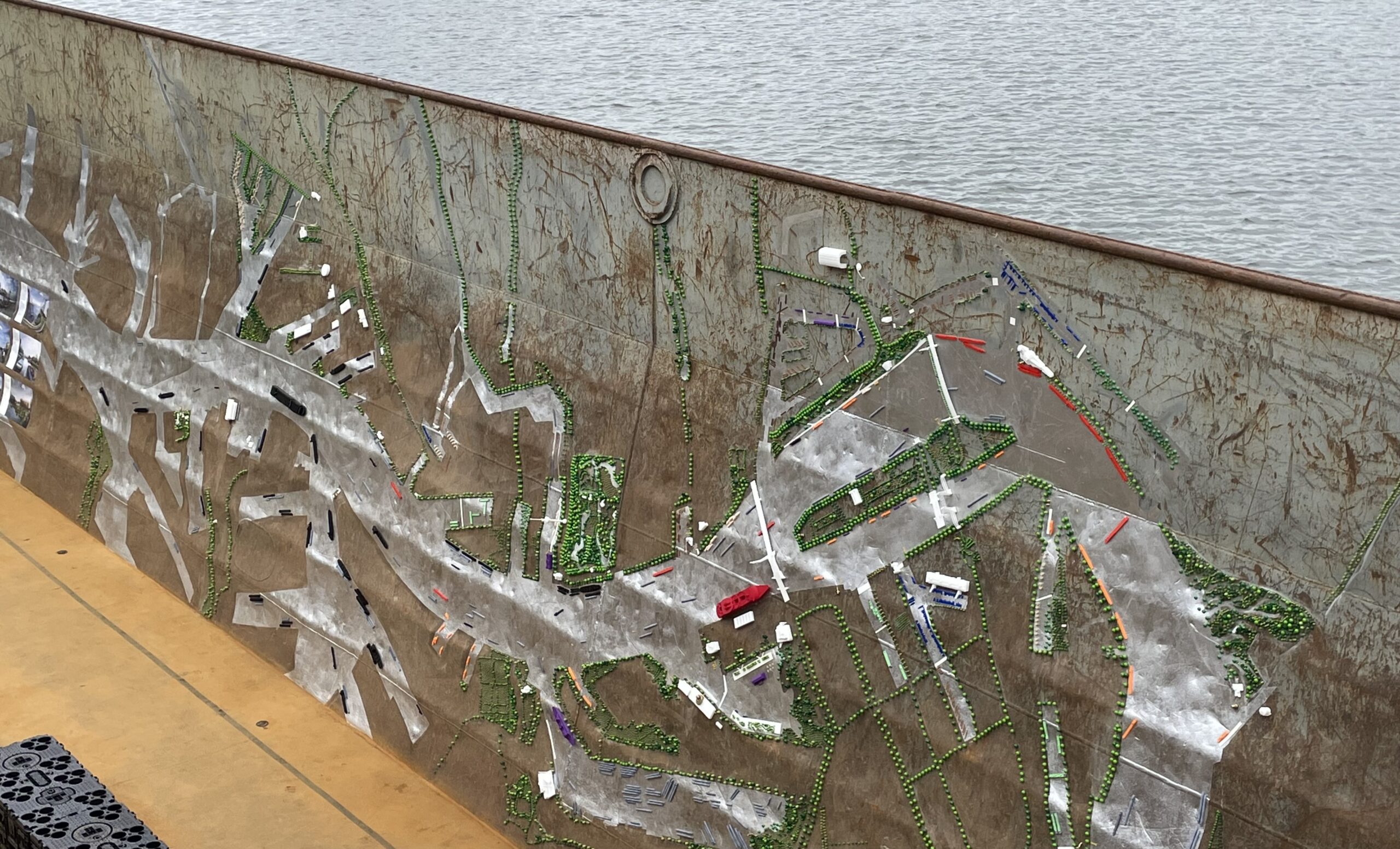
In total, eight sites have been approved, but the initial series could be the start of something far bigger — a vast ‘central park’ running down both river banks. This vision was creatively displayed on the inside of a disused shipping barge during June’s Rotterdam Architecture Month for the Liquid City exhibition. Should that ever materialize, the network of green waterfronts would line downtown and a good chunk of the former docklands that made up Europe’s largest port.

Interconnected green spaces are shown on the banks of the Meuse at Rotterdam Architecture Month by Martin Guttridge-Hewitt

“Four and a half years ago the decision was made that we need more green, and a lot more. Not just around the Meuse, but everywhere. Of course you can’t do it everywhere. So we were told there would be eight locations in the city centre, and to go away, do some homework quickly as possible, and present a study, with numbers for what it might cost,” explains Emiel Arends, urban planning specialist on City Projects who also works as part of Rotterdam’s climate adaptation programme, WeerWoord [Weatherwise]. “We only had four months to prepare, pitched it, they said OK, here’s €350 million ($387 million), go make it happen as soon as possible.”

In addition to riverside sites, City Projects also include the elevated Hofbogenpark, a narrow 1 mile (2 kilometer) micro-intervention on a former railway viaduct, and Hofplein, where urban greening will transform an already-busy square. Arends’ colleague, Pieter de Greef, senior planner and a key architect of the river-as-park masterplan, says the biggest challenge is Nelson Mendelapark. In partnership with US waterfront specialist SWA/Balsley, work has begun on an area the size of ten soccer fields at Maashaven harbour. Once complete, this will comprise hills, trees, lawns, an event space, and various tidal features, including a pathway designed to help people understand the river’s natural flow and ecosystem.

City Projects Rotterdam Nelson Mandelapark

Artists impression of Nelson Mandelapark by SWA/Balsley

“If you want square meters, Tidal Park Feyenoord is bigger. But that’s all about biodiversity, greening rivers, giving nature new places in the city… it’s not for picnics and other activities,” says de Greef of the largest approved City Projects development. “Mandelapark is much more mixed. There’s a lot of social housing around there, which is good but they do not have many balconies or public spaces. The streets are narrow, filled with asphalt and stones. This project gives 16,000 households a large green space within 10 minutes walk.”

Unsurprisingly, considering the neighborhood’s urgent needs, de Greef says the most significant achievement with Nelson Mandelapark has been keeping all available land public. Other schemes in City Projects have integrated private interests to help finance. For example, at Rijnhavenpark three large residential blocks will deliver 4,500 homes, bringing in revenue to realise the vision. Elsewhere, water companies support schemes where green-blue infrastructure can ease pressure on overloaded drainage systems.

“Each part of the City Projects has a slightly different focus,” says Arends. “So within the inner city, on the north side, a little bit further away from the river, it’s about water storage and heat reduction. Tidal Park Feyenoord is all about biodiversity, but you can walk there as well. There are actions specific to each of the parks. It’s an insane programme. I’ve never seen this before, in any city.”

Hero Image: Rotterdam’s Maeslantkering flood defences by Guido Pijper / Rotterdam Partners

Architizer is thrilled to announce the winners of the 11th Annual A+Awards! Interested in participating next season? Sign up for key information about the 12th Annual A+Awards, set to launch this fall.

Reference

Improving the climate resilience of food production with better soils
CategoriesSustainable News

Improving the climate resilience of food production with better soils

Spotted: The Food and Agriculture Organization of the United Nations found that about one-third of the world’s soils are already degraded. This threatens global agricultural production and food security. But one company is aiming to improve soil quality. 

Initially founded in 2020 by Azadeh Farajpour Javazmi with the support of the European Union (EU) parliament, the BetterSoil movement launches national and international projects to improve the quality of soils for improved climate resilience and sustainable food production. The company aims to promote sustainable agriculture both in practice and the political environment, by mobilising decision-makers at the level of the European Parliament. 

The initiative’s goal is to close the gap between theory and practice in terms of knowledge about soils and their quality in sustainable agriculture. BetterSoil connects science and research with the knowledge of farmers around the world to understand how to best improve soil fertility and build up soil humus – a nutrient-rich substance made from decomposed plant and animal matter.

Video source BetterSoil

Working closely with scientific advisors, BetterSoil develops tailored soil recipes for different regions, since each country has its own specific climate, crops, and needs. All soils are created with the BetterSoil science-derived principles in mind: appropriate soil management and agroforestry, and the use of compost and biochar. 

BetterSoil also offers education on sustainable development in order to raise public awareness, motivating people to rethink how they use resources and contribute to sustainable development. The company addresses individuals, companies, teams, and schools – it is also launching a BetterSoil Inhouse Academy. 

Healthy soil is integral to the world and its inhabitants, and improving and maintaining soil quality is vital for sustainable and reliable food production. Springwise has also spotted pre and probiotics that improve soil health and plant patches that monitor crop stress.

Written By: Anam Alam

Reference